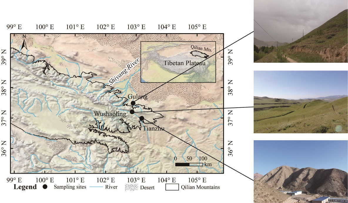
Hydrological processes produce effects on water resources in inland mountainous regions. To understand the important segments of the water cycle, a group of Chinese scientists carried out a relevant study in Qilian Mountains which were located in the northeastern edge of the Tibetan plateau, precipitation, soil, plant, river, and groundwater were collected during the plant growing season of 2016. All samples were collected on a monthly basis, except precipitation, which was collected on a per event basis. Soil and plant water were extracted using the automatic water extraction system LI-2100 (LICA United Technology Limited, Beijing, China). The δ18O and δ2H of all water bodies were measured using the liquid-water isotope analyzer DLT-100 (Los Gatos Research, CA, USA).
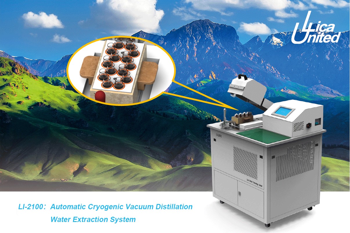
Automatic Cryogenic Vacuum Distillation Water Extraction System LI-2100
The local meteoric water line (LMWL) of the three sampling sites, using six regressions (OLSR, MA, RMA, PWLSR, PWMA, PWRMA), are presented in Figure 2. The slope differences calculated among the various regression methods were the least for Wushaoling, followed by Tianzhu, with the largest differences at Gulang. In this study, the precipitation “amount effect” was not significant, but the “temperature effect” was apparent (Table 4). The correlation coefficient between δ18O and temperature was the smallest in Gulang, corresponding to the largest slope differences among various regressions.
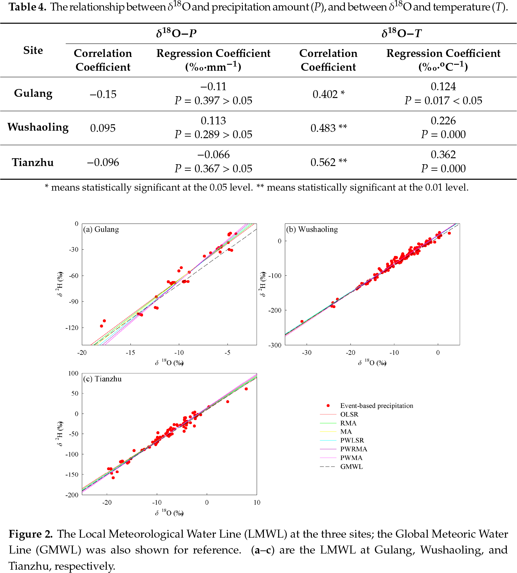
Figure 3 presented the isotopic profile and soil water content (SWC) as a function of depth (0–100 cm) during the growing season (May to September). δ18O in soil water changed significantly in the topsoil and tended to remain constant in the deep soil. From the vertical profile of δ18O in soil water, it could be seen that isotope values became increasingly depleted as soil depth increased.The δ18O values of soil water in Gulang and Tianzhu were higher during the summer (June–August) when compared to the rest of the year. It should be noted that the δ18O in soil water in Wushaoling varied significantly in the 0-70 cm depth, which indicated that precipitation infiltrated the soil up to this depth.
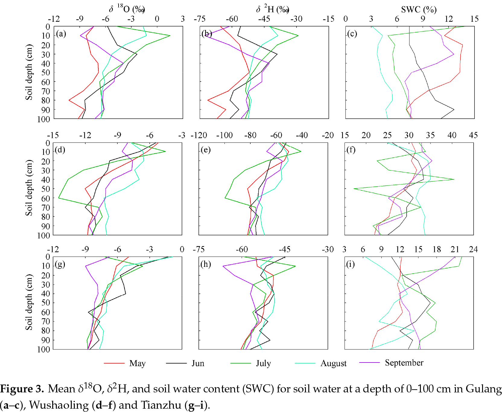
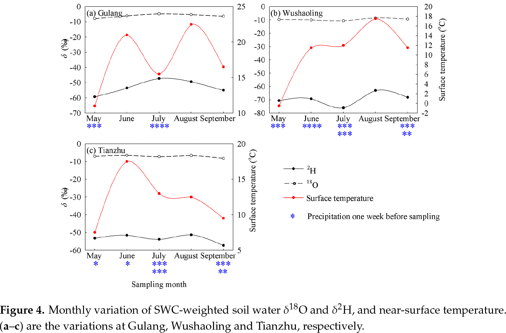
The changes in monthly δ18O and δ2H were minor, but soil temperature obviously changed. These changes showed that temperature was not the sole factor that impacted soil water isotopes, but that some other factors, like vegetation coverage, also played a part.
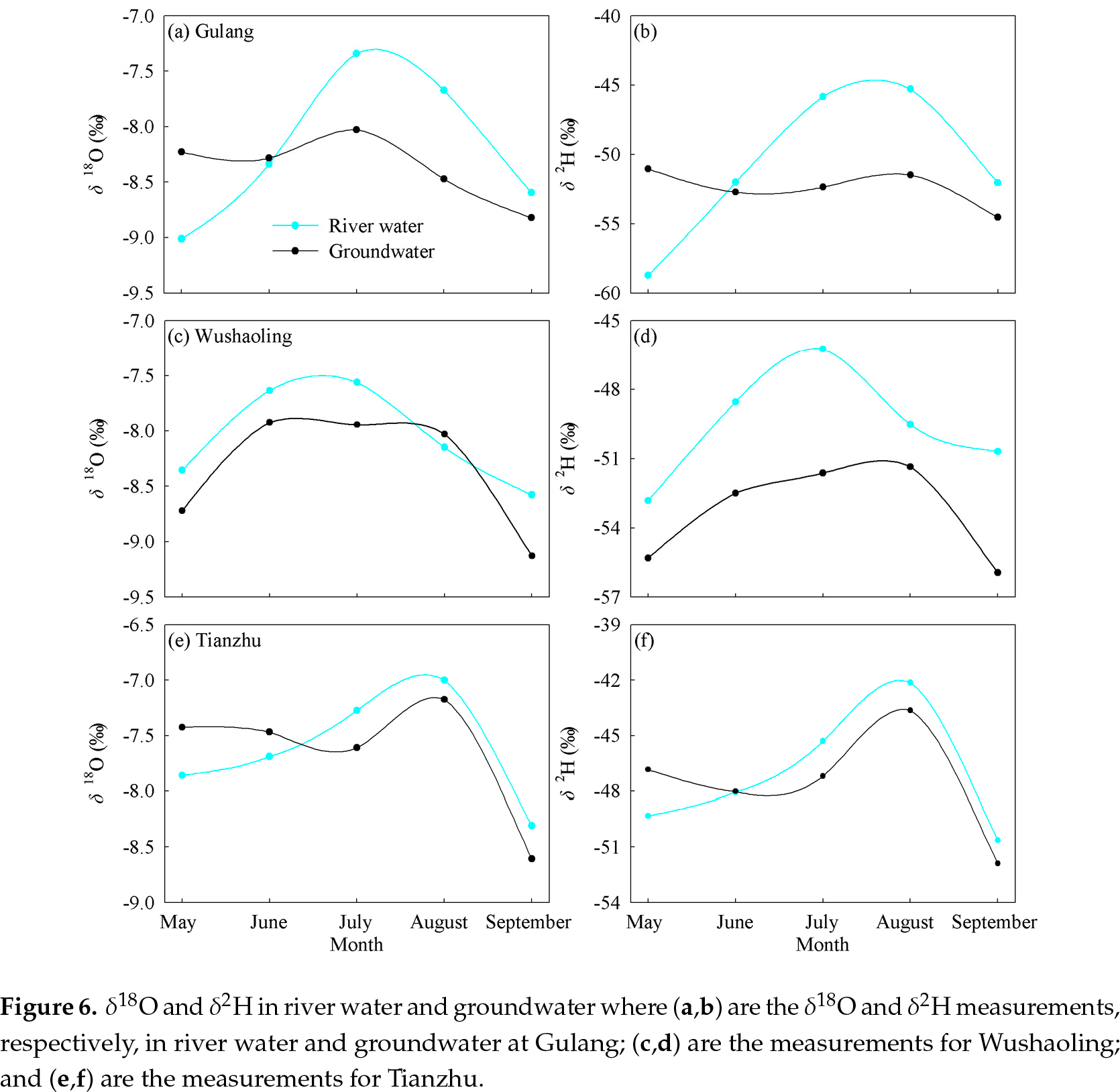
In terms of each site, the variation trend in δ18O and δ2H for river water and groundwater were generally consistent, and indicated a similar water source for the two water bodies (Figure 6). In most months, the isotope values of river water were higher than groundwater, which showed that river water experienced more evaporation due to its exposure to air. There was an intersection between the river water and groundwater sampled, which showed a water exchange and mutual-supply relationship (the intersection occurred in June at Gulang and Tianzhu, and in August at Wushaoling).
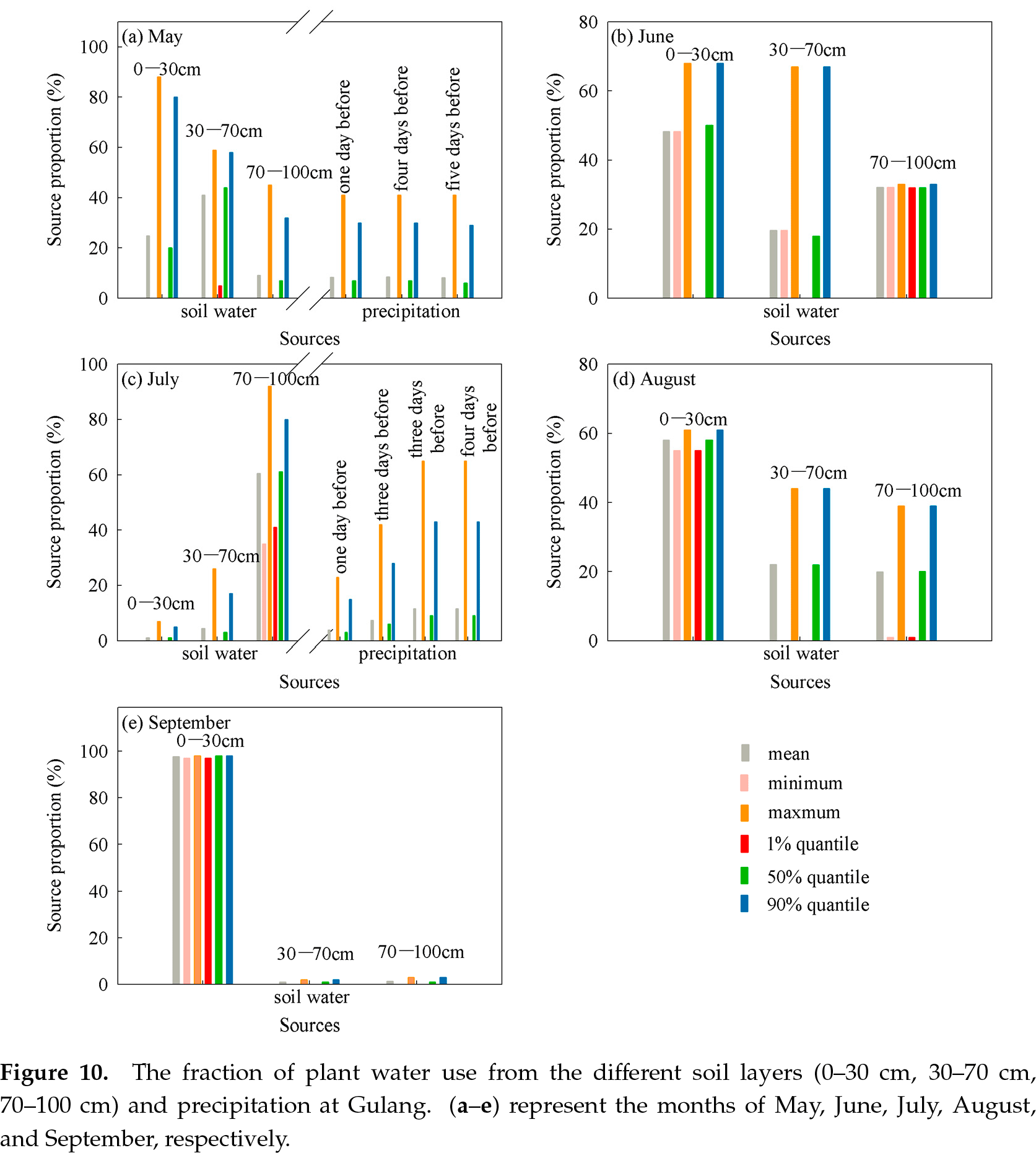
In different months, the water use pattern of the same plant was distinct. According to the mean value and the 50% quartile, the major water source for Caragana Fabr. at Gulang was from soil water, by month, at the 30–70 cm, 0–30 cm, 70–100 cm, 0–30 cm, and 0–30 cm layer from May to September, respectively (Figure 10).
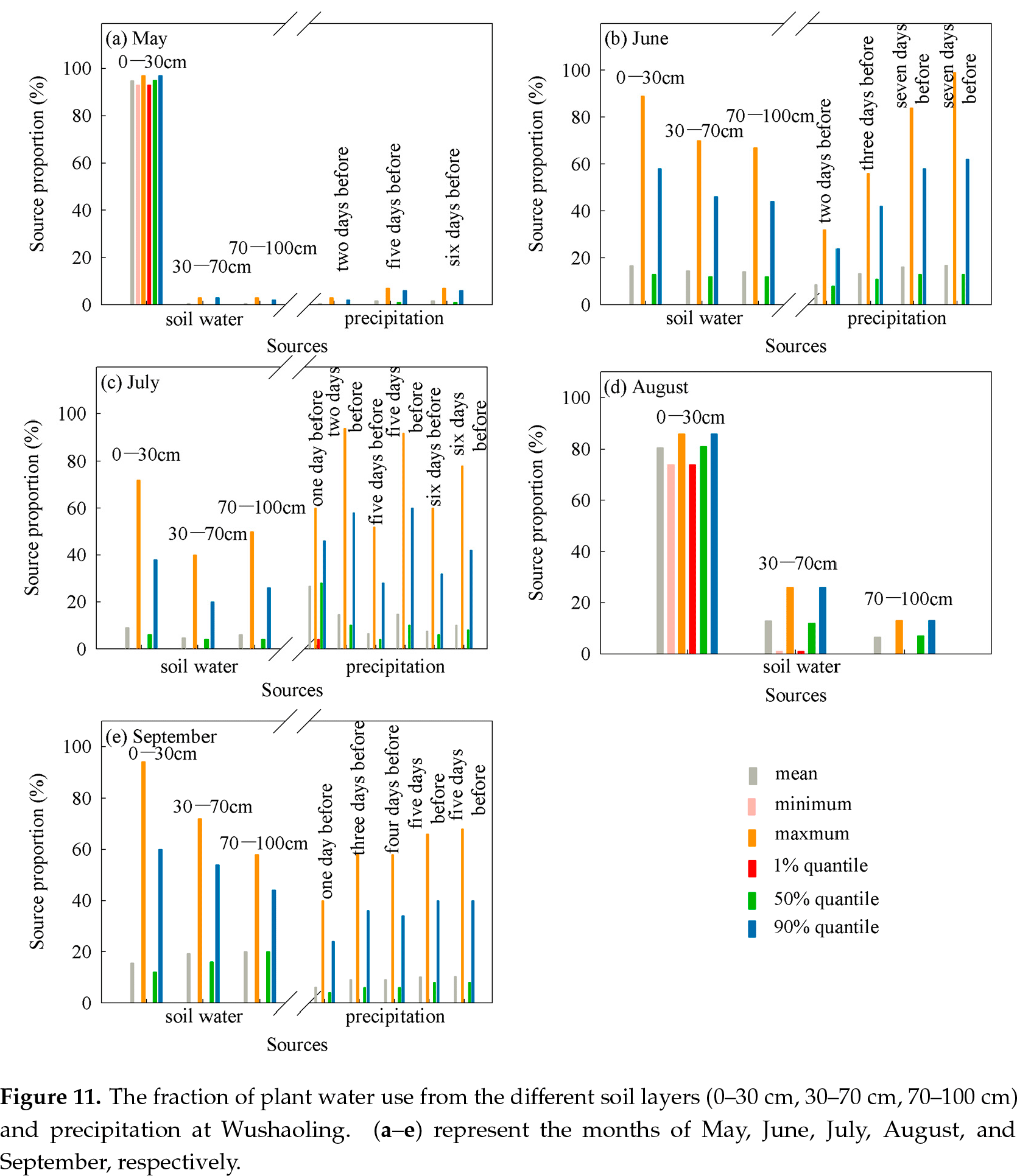
In August, when no precipitation occurred at Wushaoling (Figure 11), the major water source was also the 0-30 cm layer, the same as Gulang. In the remaining months, although there were several precipitation events, the water source was distinct for each month: the 0-30 cm layer in May, similar proportions from each soil layer in June, the precipitation event one day before sampling occurred in July, and the 70-100 cm layer in September.
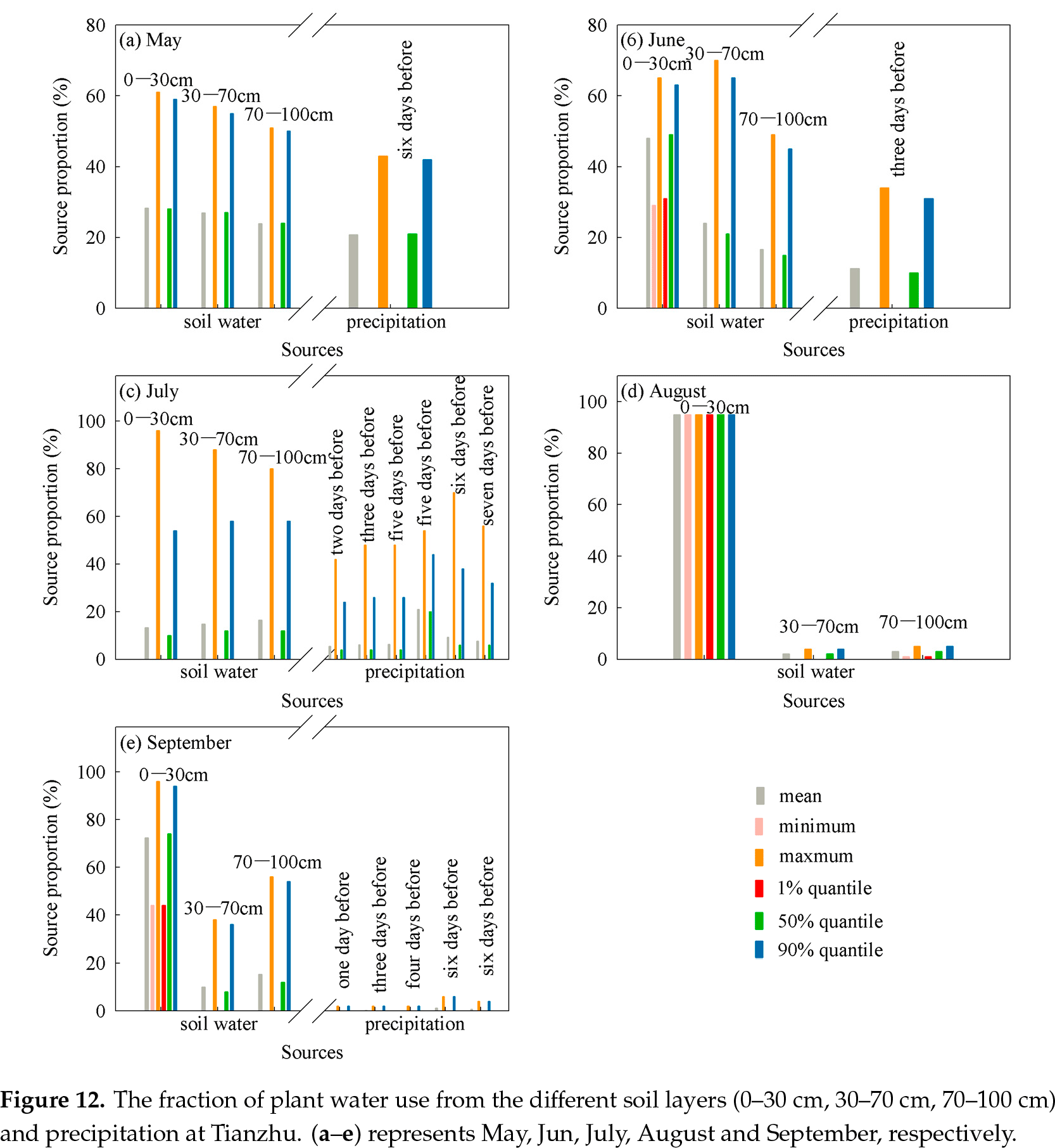
For Tianzhu, in the no-precipitation month the result was the same as the above for the other locations (Figure 12). In the other months, the water use pattern varied. The contribution of each water source to the plant water was similar in May with one precipitation event, but, in June, the proportion of water uptake from the 0-30 cm layer increased. The contribution from each water source to plant water was small in July, even with six precipitation events, but in September, with five precipitation events, the major source of plant water was the 0-30 cm layer.
Read more:
 6372142194452979949201491.pdf